
Kava data was the topic of discussion at the Pacific Data Hub Community of Practices’ final talanoa for 2021. The talanoa moderator was Dr Tess Newton Cain, Project Lead at the Griffith Asia Institute’s Pacific Hub, and our spe...
Kava data was the topic of discussion at the Pacific Data Hub Community of Practices’ final talanoa for 2021. The talanoa moderator was Dr Tess Newton Cain, Project Lead at the Griffith Asia Institute’s Pacific Hub, and our spe...
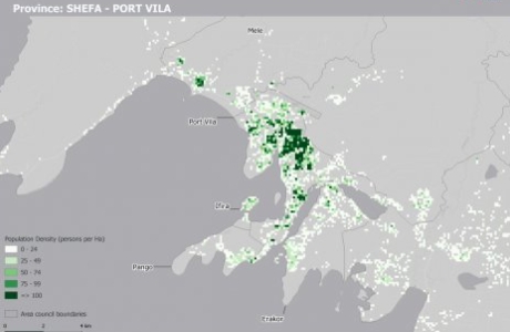
The availability of timely and reliable spatial population data is necessary when analysing a wide range of sustainable development areas such as disaster risk assessment and response, infectious disease outbreaks, water availability and coastal fisheries management.
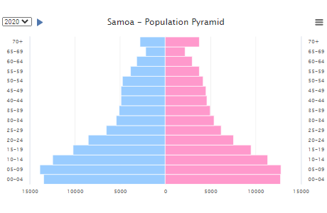
The Pacific Community's Statistics for Development Division produces regular population updates via Population Posters and Pocket Statistical Summaries.

Pacific Data Hub .Stat (commonly known as PDH.stat) is a powerful interactive online tool that presents a wide range of statistical indicators in a flexible and dynamic manner.
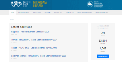
The Pacific Data Hub - Microdata Library is a gateway to the Pacific region’s survey, census, and administrative-based microdata and documentation. It is a central repository, online cataloguing and dissemination system of Pacific Island statistical microdata, metadata, reports and documents...
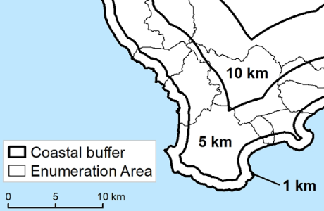
Understanding population distribution along coastal areas in the Pacific is crucial for a range of applications including food security and disaster management. A collaborative project between SPC, WorldFish and the University of Wollongong has produced the first detailed population estimates of people living close to the coast in the 22 Pacific Island Countries and Territories (PICTs).